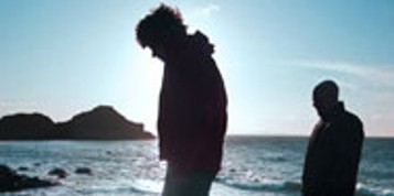
The Ballyhoura Way
The Ballyhoura Way is a wlaking route based on the remembrance of the bitter march endured by the O'Sullivan Bere clan during the winter of 1602-1603...
 The Ballyhoura Way is based upon the remembrance of the bitter march endured by the O'Sullivan Bere clan during the winter of 1602-1603. After fleeing from Dunboy Castle on the Beara Peninsula, the O'Sullivan Bere made their way under constant harassment northwards to Leitrim. Of over a thousand of the Clan who left Dunboy, only thirty-five completed the journey. The Ballyhoura Way was officially opened by President Mary Robinson and stretches from John's Bridge to Limerick junction.
There is a development plan to create an O'Sullivan Bere Trail across country, and the Ballyhoura Way will form an integral part of it. As the Ballyhoura Way is essentially a fairly short, easy, low-level route, it is of interest to those walkers who have only a little experience of walking long distances. Accommodation options feature at intervals, so that it is possible to arrange either long or short day's walks.
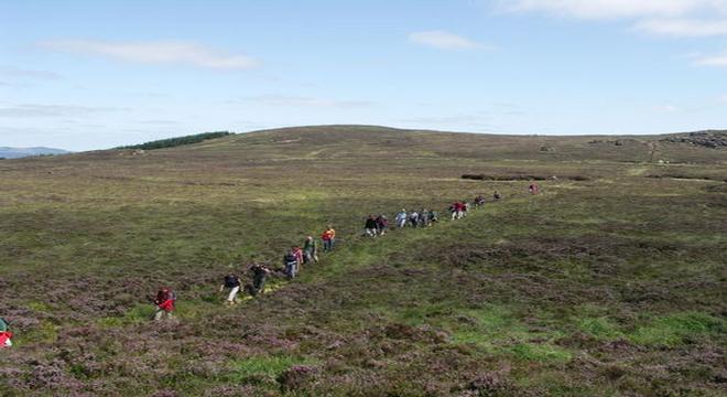
 The upland stretch across the Ballyhoura Mountains can be rather bleak in poor weather. Dozens of shorter circular waymarked walks have been built into the course of the Ballyhoura Way. These are all colour-coded, but to avoid confusion, the course of the Ballyhoura Way is consistently marked with yellow arrows throughout. There is also a waymarked link, mainly along roads, linking the course of the Ballyhoura Way with the course of the Blackwater Way. This link proceeds from the village of Ballylanders, on the Ballyhoura Way, running through the busy market town of Mitchelstown, to reach the Mountain Barrack Inn on the Blackwater Way. Arrows are Red - Yellow.
Day 1
The first day's walk along the Ballyhoura Way is from John's Bridge near Kanturk, to Ballyhea near Charleville. The whole stretch is along minor roads and many walkers prefer not to cover this part of the route, and instead start walking from Ballyhea. The road-walk passes through the village of Liscarroll, which has an impressive castle, and also runs through the village of Churchtown.The whole stretch features very little traffic and the distance can at least be covered at a rapid pace.
Day 2
Beyond Ballyhea, the Ballyhoura Way links roads, tracks and forest tracks to gain height on the gentle slopes of the Ballyhoura Mountains and views of six counties of Munster. Once the open moorland crest has been gained on Carron Mountain, the route traces the course of the Black Ditch.This ancient boundary mark runs along the crest of the Ballyhoura Mountains, and although it is a fairly clear feature, there is a need for careful route-finding in mist. Walkers cross over the rocky top of Castle Philip before descending into the forest again. Zigzagging forest tracks run downhill, then cut across the slope of the mountains to reach the Green Wood. The route runs from the tiny village of Glenosheen to the slightly larger village of Ballyorgan. Here, the impressive form of Castle Oliver will be noticed.
Day 3
Roads and forest tracks lead from Ballyorgan to the small town of Kilfinane. A full range of services are available in Kilfinane, as well as specific information about the whole of Ballyhoura Country, then the route runs towards Slievereagh. Roads, paths and forest tracks cross Slievereagh, and a short detour could take in the rocky summit of the mountain. A steep descent leads out of the forest and onto the road at Glenbrohane, and roads can be followed onwards to the village of Ballylanders.
Day 4
On the road walk from Ballylanders to the delightful village of Galbally, views towards the Galtee Mountains are enjoyed. Galbally is pleasantly arranged around a central open space and looks quite attractive. After leaving Galbally, a road leads to the tall ruins of Moor Abbey, then there is a walk alongside the River Aherlow. After climbing uphill from the river, a farm road and forest tracks can be followed down into the Glen of Aherlow. There are a range of services available throughout the scattered village of Lisvernane.
Day 5
Forest tracks and paths lead above the Glen of Aherlow to the Christ the King Statue, where a fine view takes in the length of the Galtee Mountains.
More forest tracks lead across a gentle crest and the Ballyhoura Way follows roads down to Tipperary Town. After passing through this busy town, the course of the Ballyhoura Way extends along roads beyond the town to reach the railway station at Limerick Junction.
| Suggested Walking Schedule | ||
| Miles | ||
| Day 1 | John's Bridge - Ballyhea | 12 |
| Day 2 | Ballyhea - Ballyorgan | 14 |
| Day 3 | Ballyorgan - Ballylanders | 12 |
| Day 4 | Ballylanders - Lisvernane | 9 |
| Day 5 | Lisvernane - Limerick Junction | 9 |
If you are a walk enthusiast, talk to one of our vacation in Ireland Specialist about walking tours and how to accommodate walking excursions as part of your Independent Ireland vacation or as part of your Ireland honeymoon .
Start planning your vacation... Enquire Now
Driving Vacations in Ireland
Visit anywhere in Ireland at your own pace and experience the charm
See Fly Drive Vacations
Special Offer $409
7 Day Vacation with stay in an Authentic Irish Castle.
Book Now
Honeymoons in Ireland
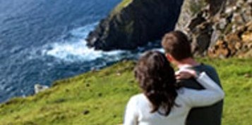
Choose Ireland for your Dream Romantic Honeymoon
See Irish Honeymoons
Escorted Tours of Ireland
All inclusive tours by luxury coach escorted by expert tour guide
See Escorted Tours
Group Tours
Enjoy Ireland with your Group
See Group Vacations